

James, a Project Developer, thought he had found a good solar project site with grid access and a favorable landowner. But as he worked through the buildable area assessment, the challenges piled up.
James waited for his GIS team to provide the constraint data he needed. It took days. He was told this was because they had to collect data from 20+ sources. But this was their only option.
Eventually, James received the data to conduct an analysis of how much of the landowner’s area was actually usable. Luckily, this area was not as challenging as other land areas he had previously looked at, he only had to discard a small part because of a protected species. He was feeling good about the project when the landowner called and said that another developer had reached out and wanted to make him an offer. Time was of the essence.
By the time it came to defining constraints, he needed Engineering’s help because the tools he was using weren’t built for Business teams. Every design adjustment forced another round of revisions, delaying decisions even further.
And when the landowner asked for a clear 3D visualization, all he had were static maps. The landowner couldn’t picture what the final site would look like and was hesitant to continue.
By this point, a competitor had moved faster, and the deal was slipping away. There had to be a better way.
Optimizing buildable areas in utility-scale preliminary solar development can get complicated very quickly. How can you take raw land and transform it into usable data that you know will yield excellent results for your solar projects? While there are many aspects to solar site feasibility, a crucial step is understanding buildable areas.
Extending beyond simply measuring the total land size of a solar project, buildable area analysis focuses on identifying areas where solar panels can be installed effectively. This involves assessing terrain, shading, and considering regulatory constraints to ensure accurate feasibility evaluations and better project planning.
However, the pre-permit stage is riddled with challenges that can stem from errors or oversights in these calculations.
In this article, we’ll be exploring why accurate buildable assessment is crucial in solar development, the common challenges and pitfalls and how tools like Glint Solar help you get buildable area assessment right the first time.
Let’s jump straight in.
Why Accurate Buildable Area Assessment is Critical in Solar Development
 A buildable area represents the specific portion of a land parcel that meets all technical, environmental, and regulatory criteria for solar panel installation. If these elements aren’t established correctly, the entire project can suffer, leading to delays, changed project financials, and even outright failure. Let’s take a closer look at how these issues can impact the bottom line below:
1. Slower Project Timelines Due to Inaccuracies and Back-and-Forths
Getting the buildable area wrong from the outset often leads to costly revisions and rework. For example, if GIS teams identify an area that seems viable but lacks proper validation against zoning laws, grid connection points, or topographic constraints, project developers may need to halt progress to revisit earlier stages.
This back-and-forth creates delays, bottlenecks, and friction between departments, slowing the overall project timeline and potentially jeopardizing agreements with stakeholders.
2. Reduced Project Success Rate
Inaccurate determination of buildable areas can severely impact a project’s viability. A site that initially appears promising might prove unfeasible once real-world constraints like slope, soil composition, or local permitting requirements are considered.
This results in wasted resources on projects that ultimately cannot move forward. A reliable approach to defining buildable areas ensures projects stay on track and minimizes the risk of failure.
3. Communication Misalignment
Solar development relies on collaboration across multiple departments, including project management, GIS, engineering, and executive teams. If buildable areas aren’t clearly defined and universally understood, miscommunication can occur.
For instance, engineering teams may spend time designing layouts for land parcels that GIS teams have flagged as unsuitable. This misalignment not only wastes time but also erodes trust and efficiency across teams.
4. Negative Financial Impact
Beyond the operational inefficiencies, an improperly defined buildable area can have a significant financial impact. Delays in project timelines increase development costs and reduce the overall return on investment.
Ultimately, errors can lead to fines, missed deadlines for incentives, or the need to renegotiate land agreements. These financial repercussions can jeopardize the profitability of not only the current project but also future pipeline opportunities.
Common Challenges in Buildable Area Assessments (and How to Avoid them)
Even with the best tools, evaluating a buildable area comes with challenges. Developers must navigate complex environmental, technical, and regulatory factors - while also avoiding common mistakes that can derail a project. Below are the key challenges and pitfalls to be aware of during buildable area analysis.
Terrain Misalignment ❌
Challenge: Errors in topographic data can lead to costly engineering interventions. Without proper terrain analysis, these issues remain undetected until later project stages.
How to fix: Make sure you use a tool that combines topography and slope data to properly assess the suitability of terrain on your solar site.
Unaccounted Environmental Exclusions ❌
Challenge: Wetlands, flood zones, and protected habitats often evade detection in superficial assessments. Without robust GIS layering and exclusion mapping, developers risk:
- Site plan rejection
- Compliance hurdles during permitting
How to fix: Integrate up-to-date environmental datasets to help minimize this risk.
Inaccurate Shading Projections ❌
Challenge: Static shading analysis often fails to account for seasonal variations and future changes like vegetation growth or new infrastructure. This can lead to underperforming energy yields.
How to fix: Relying on one-time shading estimates instead of using dynamic models and hourly solar heat maps can result in misleading production forecasts. Instead, leverage tools that integrate shading data into analyses and reports of your solar site.
Grid Connection Overlaps ❌
Challenge: A site’s proximity to substations and transmission infrastructure is crucial for economic feasibility. Poor assessment of grid connection feasibility can lead to unexpectedly high transmission costs
How to fix: Ensure you use a tool that offers grid capacity and substation layers to get a full picture of economic feasibility.

Overestimating Feasibility ❌
Challenge: Developers often focus on gross land area instead of factoring in real-world constraints like setbacks, zoning regulations, and infrastructure limitations. This inflates energy yield projections and misleads investors.
How to fix: Use software that allows business developers to conduct constraint analysis, define setbacks, buffers, and exclusion zones from the start, helping them calculate the accurate buildable area.
Failure to Engage Stakeholders Early ❌
Challenge: Waiting too long to involve key stakeholders can derail project timelines. Early collaboration ensures smoother approvals and mitigates unexpected roadblocks. This can result in unforeseen restrictions, delayed approvals, or wasted resources.
How to fix: Make sure to establish a structured stakeholder engagement plan early in the project lifecycle to secure buy-in and expedite approvals.
Navigating these challenges requires a combination of accurate data, advanced analysis tools, and proactive planning. By recognizing these pitfalls early, developers can streamline site selection, minimize risks, and set their solar projects up for long-term success.
Key Components of Buildable Area Evaluation
A thorough evaluation ensures solar projects avoid costly pitfalls and maximize long-term performance. But what are the key components that define a robust buildable area assessment? Find out below:
- Geospatial analysis:
High-resolution GIS data and satellite imagery allow solar developers to map out potential constraints and opportunities. By overlaying exclusion zones (e.g. wetlands or environmentally protected zones), solar developers can quickly identify areas suitable for PV panel installation). - Shading analysis:
Static shading analysis tools often fail to cover seasonal variations and future changes such as weather or vegetation growth. These omissions can lead to lower-than-expected energy yield. By using advanced tools that simulate shading impacts throughout the year, developers can ensure year-round accuracy and mitigate underperforming risks. - Infrastructure and grid proximity:
A site’s proximity to a grid infrastructure is critical for its economic feasibility. Inadequate assessment of transmission costs or substation capacity often results in over-budget projects. By making use of distance mapping and grid connection feasibility analysis solar developers can ensure that their site selection is cost-efficient. - Dynamic adjustments:
As projects progress, new constraints—such as updated regulations or environmental findings—may alter the buildable area. A flexible approach ensures accurate designs at every stage.
Effective Buildable Area Analysis - The Glint Solar Way
With Glint Solar, developers can complete a buildable area analysis in a fraction of the time, leveraging centralized layered data sources, engineering-approved designs, and realistic 3D visualization designed to increase your project pipeline and shorten negotiation times with landowners and municipalities.
To perform a buildable area accurately, you need a seamless, integrated workflow that combines all the necessary tools and data into a single platform. Follow our step-by-step guide below for effective buildable area analysis.
Centralized Layered Data for Quick Site Evaluation
One of the issues with buildable area analysis is that it requires you to manually collect different layer data, often from upwards of 20 or 30 sources. This causes huge delays and inefficiencies between departments that drastically slow down project timelines.
Using Glint Solar’s Layers library, Project Developers can select from over 100 layers, or upload their own data, without ever having to leave the tool. This library is consistently updated and contains everything you need to get buildable area assessment right from the start including:
- Infrastructure layers like substation locations, grid lines and contour lines
- Protected, flooding and wetland areas
- Market-specific data to support new market expansion
Consolidating this key GIS data helps to streamline the project verification process and reduces the reliance on multiple tools, while also enhancing overall productivity.

Easy-to-Use Design Tool for Business Teams
The constraint phase of the buildable area assessment can also pose significant challenges. Solar development teams need to set specific exclusion zones for infrastructure and environmental constraints to achieve the most accurate buildable area. Traditionally, however, the Engineer is required to perform this thanks to overly technical tools not designed or adapted for business teams.
Glint Solar addresses this challenge with a tool designed specifically for Project Developers and Business teams, allowing them to create preliminary project layouts and define exclusion zones for site access, buildings, roads, and other infrastructure on their own.
For example, it could be necessary for you to include a buffer zone of 10 meters around the perimeter of your solar project to adhere to environmental regulations. Likewise, you’ll want to factor in the space you need for access points, equipment storage, inverters and batteries, and more.
For Business teams, having an easy-to-use tool means a faster initial site assessment without relying on Engineering, empowering them to take ownership of preliminary layouts and helping to improve efficiency, collaboration, and landowner negotiations.
For Engineering, this means less time is spent on non-technical tasks, allowing them to focus on deeper feasibility analysis and design optimizations for later-stage projects.

Engineering-Approved Design for Simplified Buildable Area Analysis
A substantial bottleneck in buildable area assessment is an inefficient workflow between Project Developers and Engineers. Engineers will often use AutoCAD or other tools to define the electrical design and layout configurations of a site. However, this process is time-consuming and slows down the decision-making process. The result: Engineers are pulled away from later-stage projects and labored with additional work while Project Developers are forced to wait.
Glint Solar empowers the Project Developer to predesign layouts and make changes themselves with engineering-approved settings (analysis configuration settings) directly in the tool. By integrating structured technical data and evaluation guidelines (including inverter or panel types, AC/DC ratio, panel orientation, ground coverage ratio, row distance, and more), Glint Solar facilitates a seamless transfer of technical information for precision evaluation and accelerated decision-making.
To make things even easier, profiles with different technical configurations can be used and customized based on project requirements.

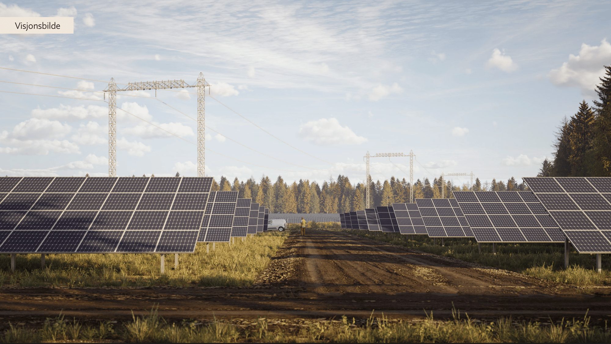
3D Project Visualization
3D visualization isn’t just a nice-to-have - it’s essential when showcasing your project to key stakeholders like landowners, investors, and municipalities. It provides a clear, tangible representation of how a solar site will integrate with the landscape, helping to secure buy-in early in the development process.
However, producing an accurate and appealing 3D render often requires external engineers or consultants, which adds time and costs to an already complex project pipeline.
Using Glint Solar, creating these 3D visualizations is simple and can be created by Business Development teams in seconds, removing reliance on external specialists for this task. 3D visualization can also be a useful tool to identify quick changes and last-minute adjustments that need to be made.
For example, a landowner might view a 3D render and ask to exclude a specific area due to trees or existing infrastructure not picked up during the initial assessment. With Glint Solar, the design can be easily updated by Business teams in seconds, and a new render can be created.
In addition, Glint offers a comprehensive project evaluation report that includes key insights into PV system performance and yield, geographical data, and irradiation metrics. These reports are also generated in seconds and help to enhance stakeholder transparency.
By integrating 3D visualization directly within Glint Solar, teams can collaborate more effectively, reduce bottlenecks in decision-making, and ensure that technical feasibility is validated early - ultimately accelerating the path from site identification to project execution.
Check out the video below to see this process from start to finish:
How Chint Solar is Saving 2000 Engineering Hours Per Year With Glint Solar
To see this in action, let’s take a look at how Chint Solar used Glint Solar. Evaluating solar sites was hindered by the fragmented nature of GIS data, dispersed across various tools and geoportals. This scattered approach resulted in time-consuming and error-prone data evaluation processes, impeding the efficiency of project evaluation and decision-making.
Chint Solar's Engineering team also spent around 60 to 70% of their time evaluating the pre-permit stage projects. This intensive focus on preliminary projects was taxing, given the company's expansive operations across multiple countries and numerous projects.
There was a pressing need to empower non-technical business teams with these skills to expedite project lifecycles. This challenge highlighted the importance of knowledge transfer and autonomy in decision-making processes.
To mitigate this issue and reclaim valuable engineering resources, the company initially developed internal tools and outsourced engineering tasks to external service providers. However, this approach posed challenges, including cost implications, the complexity of the design process, and issues related to the availability and flexibility of external engineers.
Glint Solar streamlined Chint Solar's global project verification process, centralizing GIS data layers and simplifying site evaluations.
By providing an easy-to-use interface and layer library, Chint Solar was able to effortlessly access all the layered data they needed, eliminating the need for multiple tools. The integrated preliminary design tools facilitated fast yet accurate project layouts for their Business team, while centralized technical data and engineering-approved design accelerated decision-making. Glint Solar also enabled detailed project evaluation reports and enhanced stakeholder communications with 3D visualization.
Using Glint Solar also boosted Chint Solar’s solar project portfolio. This was particularly notable in Italy and France where the adoption of the tool spurred greenfield development processes.
Overall, Glint Solar transformed Chint Solar's solar site evaluation process, driving efficiency and collaboration across teams on their path to a sustainable energy future.
Read the full case study here.
